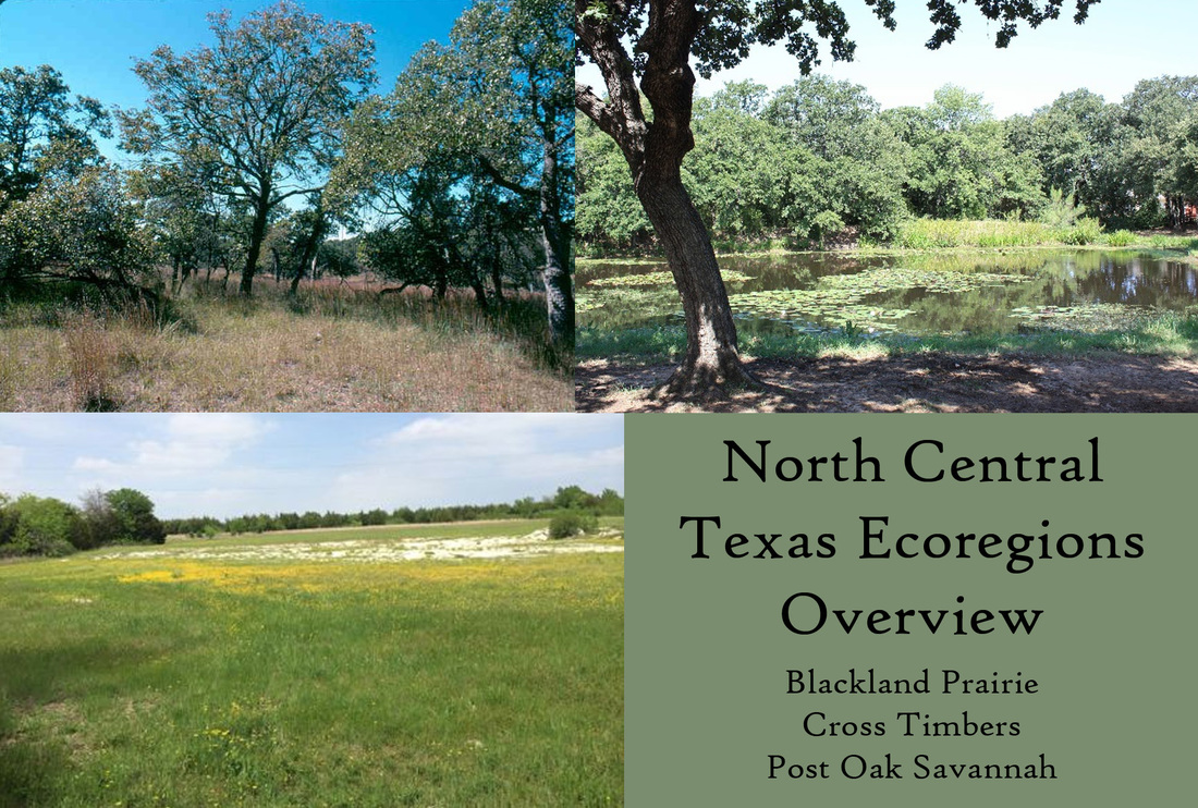
 When I say “Texas ecoregion,” I do not mean the general geographic distributions we generally think of. I’m not thinking “panhandle,” “west,” or “central hills.” That doesn’t tell you anything about the soil and the flora. An ecoregion describes the changes in the ecosystem across a geography. When I hear “Blackland prairie,” I not only know the soil type, but what kinds of trees, plants, and animals I can expect there versus another ecoregion. Shinners and Mahler spent a great deal of time on North Central Texas flora. Their book, a massive volume that would break someone’s head if you dropped it from a height, is called Illustrated Flora of North Central Texas. If you’re serious about Texas, I recommend you buy this book. It’s a hundred dollars well spent. Much of the information I’m going to give you comes from their book. It was my textbook in university, and for good reason.  Photo from www.nwflec.com There are several factors influencing Texas ecoregions: temperature, the Gulf, geology, and the overriding climatic pressures of being part of a great and diverse continent with a lot of stuff going on. Texas has almost everything possible (not as diverse as California, but we try.) The Blackland Prairie alone has three different types of soils, though I’ll spare you that for this overview. Temperature in Texas works along a diagonal from the Panhandle to the Gulf. It’s not a perfect description, and a meteorologist is probably crying somewhere, but it’s good enough. And because rainfall goes in an east-west pattern, this can make some complicated weather patterns towards the interior of the state. The eastern half of Lampasas County gets on average 15 more frost free days than its western counterpart. Texas is tricky. Things can change drastically between a county or within a county. When looking for a permaculture designer, it is critical to find one who knows YOUR county and YOUR ecoregion. The soils are different. The plants that prefer your region may be completely different from someone on the other end of the county. You have to endeavor to learn your place well.  Average Last Frost Dates in Texas Photo from texassorghum.org The Gulf affects a lot of Texas, though its effects decrease the farther away from the coast you get. Obviously, humidity and rainfall are impacted. The Gulf moderates temperature and climatic extremes. You are less likely to experience long droughts and wide temperature fluctuations the closer you get towards the coast versus inland. Massive bodies of water have that effect on climate. The soil also tends to get more acidic and sandy, as salt, wind, and rain buffet the landscape. Here in North Central Texas, those factors are less apparent. For us, the Gulf influences our wind and rain patterns the most. I specialize in the Cross Timbers, Blackland Prairie, and Post Oak Savannah, so those are the ecoregions I’m going to describe today. That includes approximately 70 counties in Texas. Two things contributed most to the stability and health of these three regions: fire and ungulate migration. Fires, either natural or induced, kept shrubbery and opportunistic species under control. It revitalizes grasses, doesn’t really harm trees that much, and clears land of green briar, weeds, and plants that cannot survive the burn. What you are left with are patches of strong, slow-growing trees like black hickory and oaks, and lush, open grassland. It is nature’s method of spring cleaning. There are also some species that require the fast, intense heat of a grass fire to reproduce, like the Longleaf pine. Buffalo and other migratory species did their part by spreading seeds, churning the soil, and fertilizing the ground. They stayed long enough to mow and then did not return until the next year, leaving the grasses time to rebuild, grow deeper roots, and survive. This migrational pattern is critical to replenishing and sustaining prairie. When a grass is allowed to grow to full height, cut down, and then allowed to seed, the grass becomes thicker and stronger. When grass is cut repeatedly, its roots eventually degenerate to match its height. That means a grass kept at three inches can only maintain roots that are three inches. And you wonder why our lawns and pastures have such drought problems. They can’t grow the roots to grow strong and deep. But a migrational pattern strengthens the grass. Many native grasses under this system can grow roots reaching twelve to fifteen down in the soil. 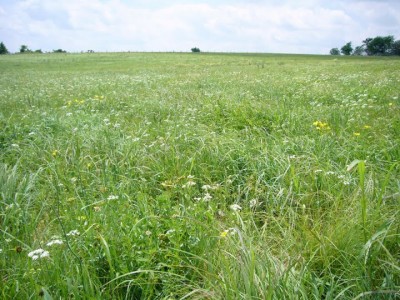 Photo from texasprairie.org Blackland Prairie This region takes up the eastern half of Bell County, my main stomping ground. Interstate-35 cuts the county in half and runs straight up the Blackland belt from Austin to Dallas. Why build a huge road there? The prairie is flat (gently rolling at worst), relatively free of trees, and a great place to move thousands of head of cattle from north to south. It’s a natural thoroughfare if there ever was one. Most of Texas’s largest cities grew up on this strip. The clay is black, alkaline, and waxy, with white limestone bedrock. My property for example is 98% clay and it takes ages to dry out, which is both a blessing and a curse. Clay holds a lot of water and a lot of nutrients because of its tiny particle size, but it suffers from a lack of oxygenation. It can also be easily compacted. Care must be taken with this soil type to increase its organic mass with large particles, such as compost, to improve aeration, and to walk on specific paths. You don’t want to walk on your growing places. The clay can be difficult to break through, so plants with thick, penetrating roots do better. For root crops, round roots can break up the clay better than long, thin roots. For example, beets are a better choice than carrots. Percolation, or the movement of water through a medium, can be an issue. Plants that can break up the clay are a valuable and critical asset to this soil type. This soil is considered one of the most fertile soils west of the Mississippi. Pioneers immediately started farming it with success, though their wagons often got stuck in the mud. The clay has this habit of getting wet from rain and expanding, drying out, and forming these huge cracks when the soil shrinks. Loose particles fall into the cracks. When it rains again, the soil fragments expand, exert lateral pressure, and create a series of mounds and depressions called a gilgai. This irritated the pioneers a lot. Some of these cracks were two feet deep and the depressions up to twenty feet across. Wagons couldn’t pass through in wet weather, but wow, the soil will grow some grain. It was once the greatest cotton producing region in the world. Another thing you may want to consider is what we affectionately call the I-35 corridor. Tornadoes love moving along the Blackland. I actually had an MRI scan done in Temple once when there was a tornado warning outside. It was just a warning, but tornadoes can and do occur much more often in the Blackland than if you went a little west or a little east. This should not be surprising. The Blackland is flat, weather patterns mix there, and stuff happens. Only 1% of native Blackland Prairie remains. I will be writing an article about Blackland prairie restoration for those who are interested in grasses that are six feet tall with roots twice as deep. Blackland is a true prairie with a huge variety of grasses. There are several types of grassland communities. Little bluestem is a main contributor. Oaks and trees are generally restricted to ravines, rivers, and streams, or certain protected areas. Every five or ten years, wildfires would run through the prairie. This often destroyed young trees and kept many species to rockier areas, particularly the mountain cedar (Juniperus ashei), and kept the grassland as a grassland. Now that urbanization and cultivation have made burnings almost nonexistent, opportunistic species such as cedar and mesquite are taking over. Overgrazing by livestock mismanagement has further altered and maligned the native flora. This pattern follows for the other Central Texas ecoregions, who are drastically changed, if maybe not as much as the Blackland. 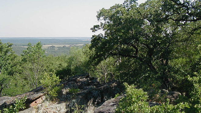 Photo from static.wixstatic.com  Photo from www.beg.utexas.edu Photo from www.beg.utexas.edu Cross Timbers and Prairies The Cross Timbers are west of the Blackland and includes the Lampasas Cut Plain, which is its own special thing and sometimes considered part of the Edwards Plateau. It stretches up into Oklahoma and Kansas. While not technically part of the Great Plains like farther west, it has the last vestiges of timber and shrubbery from the eastern forests before you get to pure grassland. It gets higher in altitude as you go farther west, and the western Cross Timbers are often called the Upper Cross Timbers. The soil is predominately clay, but has much more sand in it, and the topsoil tends to be thin and easily eroded. The bottomland has thicker soil, but up on the hills, you can often scrape off the topsoil with your boot. The pH can vary slightly due to the higher sand content, and for central Texas, could be considered acidic in some places. The soil has a high mineral content. The well water can taste funny because of it. There are many ravines, canyons, and rocky outcroppings in the hills. For this soil type, keeping the soil in one place and preventing erosion is most important. Topsoil is precious here and should be cared for properly. Even mild disturbance can rip off whatever soil you might possess, leaving only bare rock and sand. Overgrazing is extremely dangerous as the grass holding the topsoil is removed and it just blows away. Farming can be difficult due to the lack of soil, but can be rewarding with due diligence and effort, as it generally does not have the extreme drainage and percolation problems of Blackland. Cattle ranches are the main component of agriculture in the Cross Timbers. Mismanagement has seen to the destruction of much of the native flora and has allowed opportunistic species to invade where soil remains. If raising livestock in this ecoregion, migrational patterns and livestock rotation are necessary to sustain and build the soil. Effort should be made to imitate buffalo grazing patterns where at all possible. The flora is patchy in the Cross Timbers, ranging from open to dense, with multiple species of oaks, elms, and other deciduous trees. Post and blackjack oaks predominate along with live oaks, all of which are considered unattractive species for logging compared to others. Because of this, the trees were relatively untouched. Now, the oaks see the most decline from oak wilt and competition with mountain cedar who have been allowed to encroach due to fire suppression. Entire hillsides may not boast a single oak anymore. There are multiple communities of shrubbery and herbaceous plants that make up the forest sections. Because of the poor soil, the plants here tend to grow slowly, but with determination. Many people have marveled at an oak apparently living on nothing but several feet of rock. 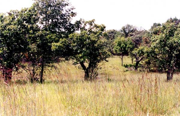 Photo from oaksavannas.org Post Oak Savannah
The Post Oak Savannah is almost like the strange love child between the Pine Woods and the Blackland. It is its own distinct ecoregion, but is dispersed between what would otherwise be Blackland or Piney Woods. Some people consider it part of Blackland, but some don’t. The soil gets gradually more acidic as you go east. Bottomland is mostly clay as particles wash down from higher elevations, and the uplands contain more sand. There is usually a dense clay pan underneath the soil, which affects how water moves across the landscape. Percolation can sometimes be a problem. This makes the care requirements for this region a bit of a mix, but generally erosion and overgrazing are the biggest issues. Soil can be thin, but not as thin as the Cross Timbers. This area generally receives less rainfall than the Piney Woods. The flora of this region is variable and some areas appear more transitional than others. Trees are a mix of post oak, blackjack oak, red cedar, and Lobolly pines as you get farther east. The grasses are of a bunching Blackland type where there is more open ground. Flora from the east mix with flora from the west, and combine to make their own special assortment in the savannah. Both the Savannah and the Cross Timbers have oaks, but they are different species and types of oaks. Plants tend to stray from the heavy alkalinity of the Blackland to their more acidic counterparts. You may actually be able to grow blueberries here, if you find a particularly acidic spot. Just like in the other two ecoregions, fire suppression and overgrazing have extremely altered the native flora and soil quality of the Post Oak Savannah. Little of the old growth forests remain and most area has been converted to pasture or open range for cattle. Mesquite, yaupon, cedar, and others have started to take over from the oaks. Almost all of the native bunching grasses have been replaced by exotic grasses like bermuda and bahaia. The diversity of the landscape has drastically declined and many of the species dependent on certain plants have dwindled or fled to other areas. This has also destroyed much of the soil and the land cannot support what it used to. The Post Oak Savannah provides a unique opportunity for the permaculturist with it being such a transitional area. Things that would not be possible in the Piney Woods or the Blackland may be possible in the Savannah. Comments are closed.
|

Rebecca Burrow
I am a Christian permie designer trying to spread the word about Christian land stewardship through permaculture. I like goats a lot. Maaaaaaaah. Archives
September 2016
Categories
|
 RSS Feed
